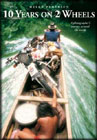
 GET IT HERE GET IT HERE |
- HELGE PEDERSON - |
||||||||||||||||||||
 GET
IT HERE GET
IT HERE |
- CHRIS SCOTT- Chris Scott's 5th edition. |
||||||||||||||||||||
 SELECT MAP SELECT MAPat Right > |
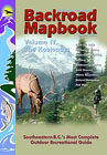
- - - - - - - - - - - - -BACKROAD
MAPBOOK Up to date, near topo detail for British Columbia and S.W. Alberta and some areas in Ontario, Canada. These are THE maps to get to put together adventures on the roads seldom travel! Also contains pages of tips on hiking trails, fishing, wilderness camping, paddling routes and more. Mapbooks available for these areas:
|
||||||||||||||||||||
 GET IT HERE GET IT HERE |
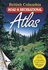
This atlas divides the entire province from the U.S.A. border in the south to the Yukon border in the north, into 88 - 8 x 10 inch maps. Scale of Atlas maps is 1: 600,000. |
||||||||||||||||||||
 GET
IT HERE GET
IT HERE |
-
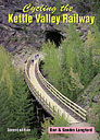
- - - - -Cycling the Kettle
Valley Railway A detailed kilometer by kilometer account of the entire length of the KVR and it's many connectors. Includes detailed maps, safety tips, historic information and accommodations. Be aware this book was written in 1997 so there maybe some physical change to the road bed due to washouts and slides, but for the most part this is the most complete guide to the route! PLEASE NOTE - There are sections of the KVR that are used by mountain bikes and horse back riders, PLEASE be courteous of their space - don't roost them or you'll ruin it up for everyone else! |